LLEN Boundaries
The 31 LLENs cover all areas of the State of Victoria. LLEN boundaries usually cover more than one Local Government Area (LGA) and are generally contained within an individual Department of Education Region. LLEN boundaries were originally determined by factors including: a clear local community of interest, LGA boundaries, size of target population, DE Regional boundaries, DE school cluster/network boundaries and other cluster and service provider boundaries. Any change in LLEN boundaries must be agreed by all of the LLENs affected and DE and must ensure that state-wide coverage is maintained.
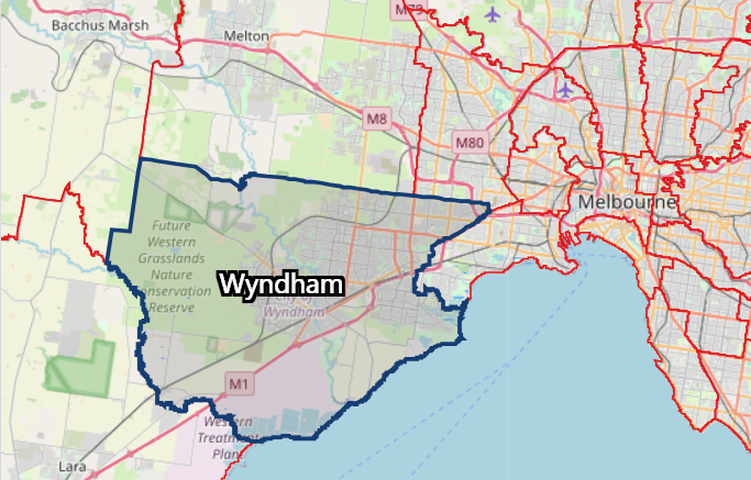
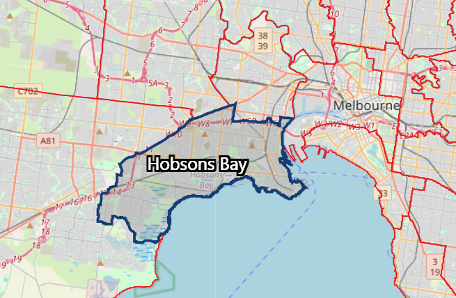
The WynBay LLEN region comprises two local government areas: Wyndham and Hobsons Bay.
Wyndham Region
Population
333,015
forecast.id 2025
Land area
541.8
square km
Population density
622.0
persons per square km
Hobsons Bay Region
Population
94,705
forecast.id 2025
Land area
64.20
square km
Population density
1,490
persons per square km
Source:.id Resources
Localities:
The City of Wyndham includes the suburbs and localities of Cocoroc, Eynesbury (part), Hoppers Crossing, Laverton (part), Laverton North, Little River (part), Mambourin, Manor Lakes, Mount Cottrell (part), Point Cook, Quandong, Tarneit, Truganina (part), Werribee, Werribee South, Williams Landing, and Wyndham Vale.
Localities:
The City of Hobsons Bay includes the suburbs and localities of Altona, Altona Meadows, Altona North, Brooklyn, Laverton, Newport, Seabrook, Seaholme, South Kingsville, Spotswood, Williamstown, and Williamstown North.